Lines drawn, crossed, and redrawn across maps and lives.
The drawn and carved line moves between map, wound, route, and division. Geography is never distant here; it is experienced through bodies, families, and belonging.
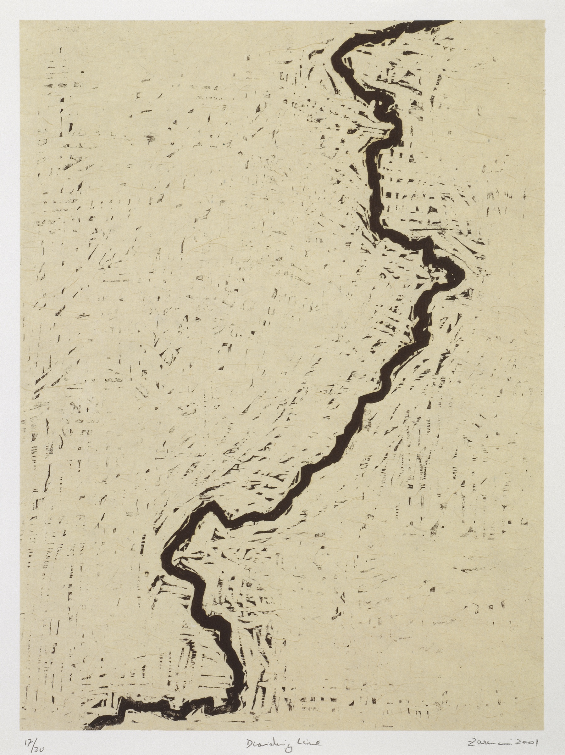
Dividing Line, 2001Zarina
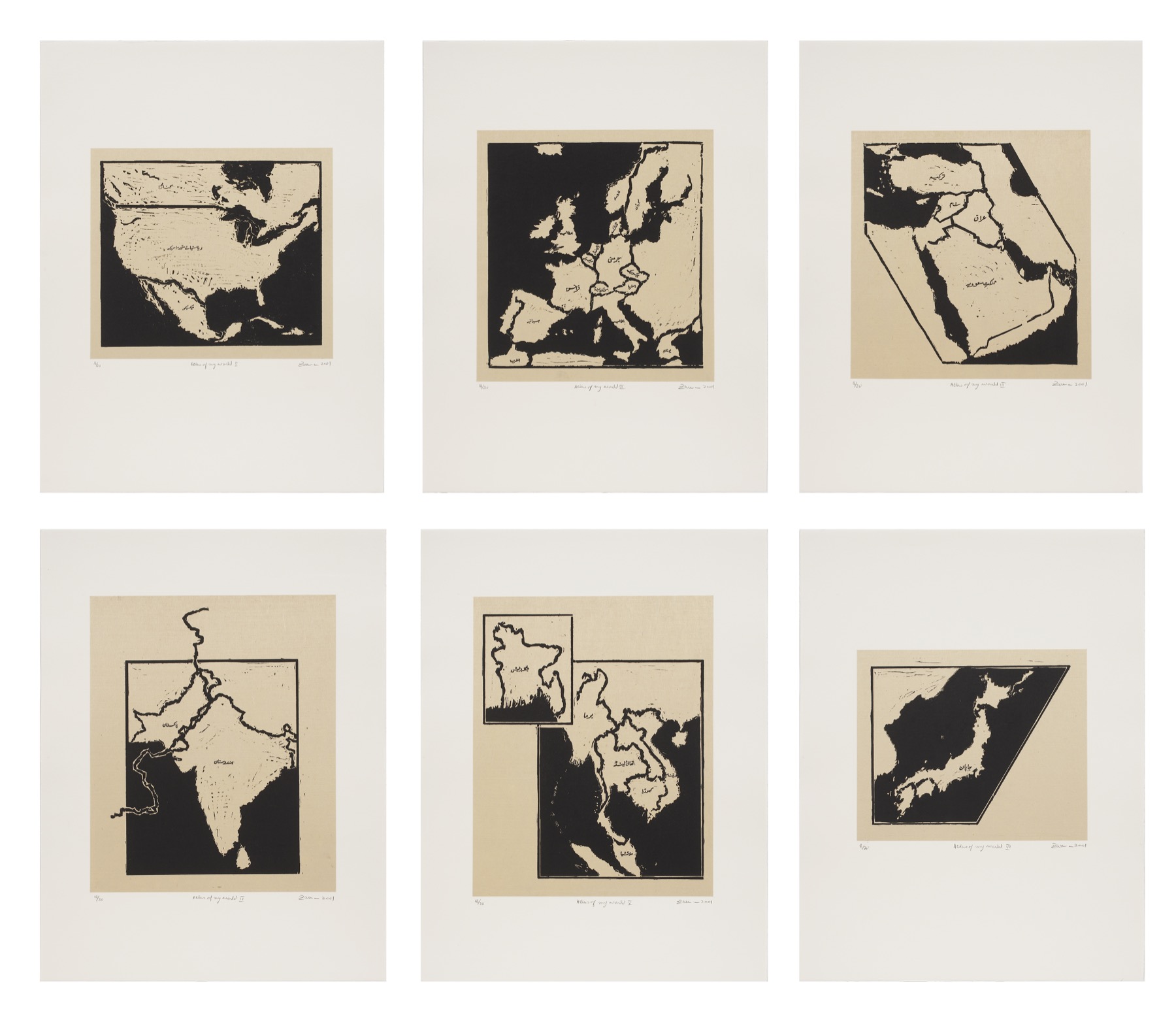
Atlas of My World2001
Reading the theme
Borders as lived experience
Zarina’s maps do not pretend that geography is neutral. A border may begin as a line on paper, but its consequences are carried through bodies, families, languages, and generations.
For Zarina, a border was never an innocent line. It could divide land, language, family, and the idea of belonging itself.
In Dividing Line, the boundary cuts vertically through the sheet with the physical insistence of a wound. Maps recur throughout the work, but geography is always felt through the body.
Her maps refuse the detached authority of conventional cartography. They register places as lived histories: crossed, renamed, remembered, and altered by political power.
The act of carving is central to this meaning. A border appears through pressure and removal, so the image carries the physical trace of separation in the way it was made.
Ways of looking
Three paths into borders
Biography, material, and form meet differently in every series.
01
The carved line
In Dividing Line, the boundary rises through a dense printed field. The line is produced by cutting away the block, making absence itself the most forceful part of the image.
02
Maps after Partition
The political division of the subcontinent in 1947 remained a formative historical fact. Zarina returned to borders not as a single past event, but as an ongoing structure of separation.
03
From nation to displacement
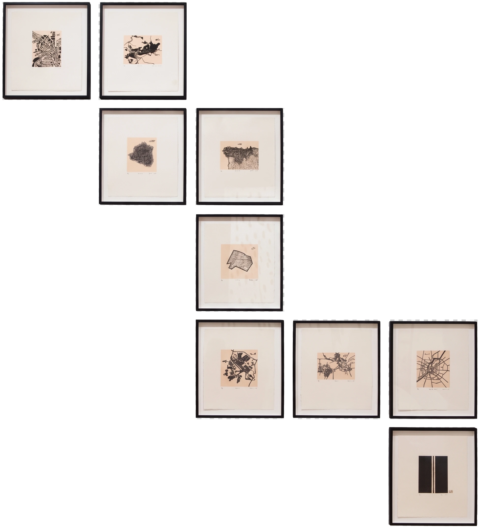
Her later map works widen from South Asia to damaged cities, contested territories, refugee routes, and dark seas. Cartography becomes an account of vulnerability rather than mastery.